Lab
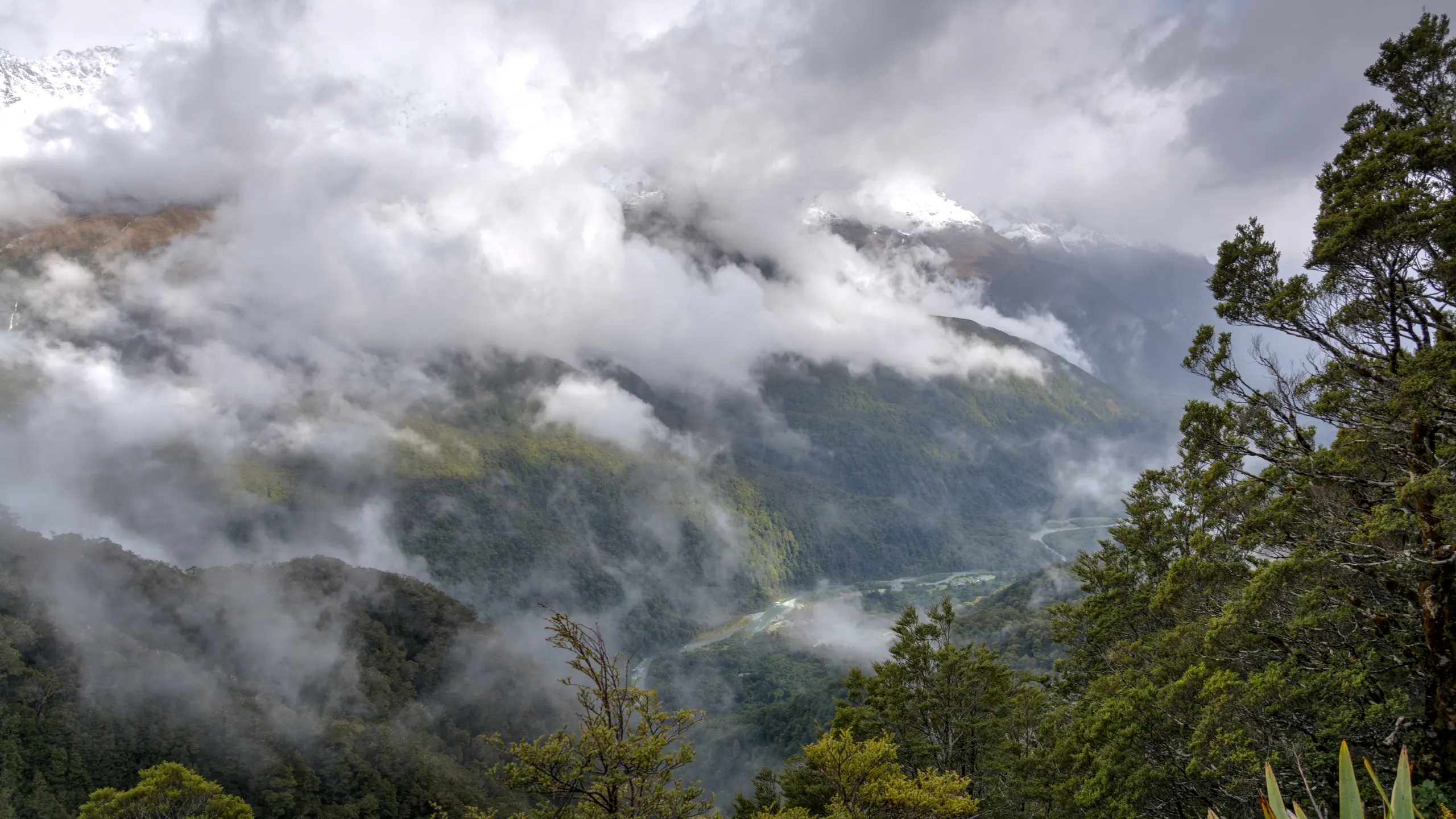
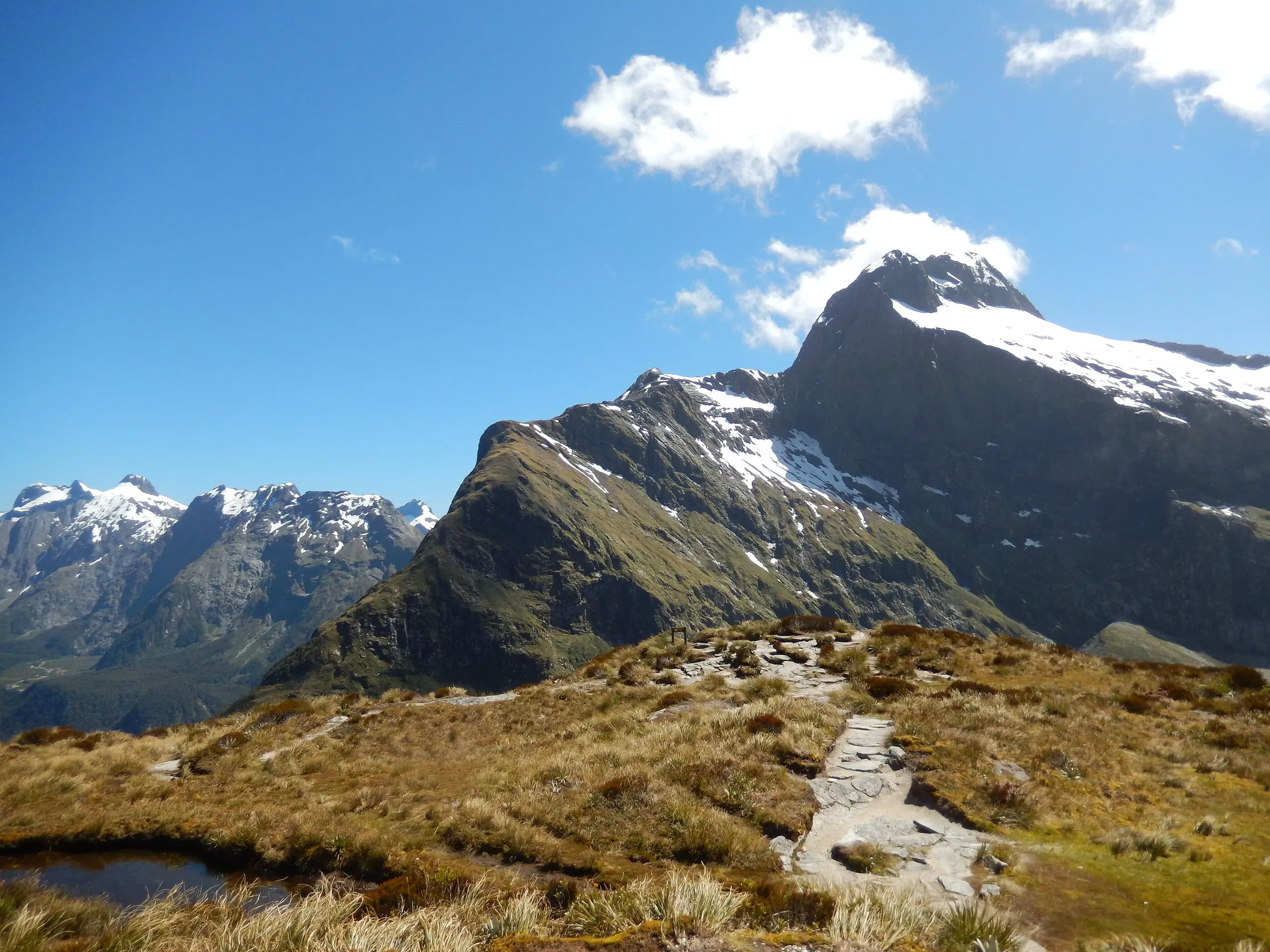
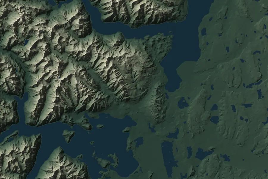
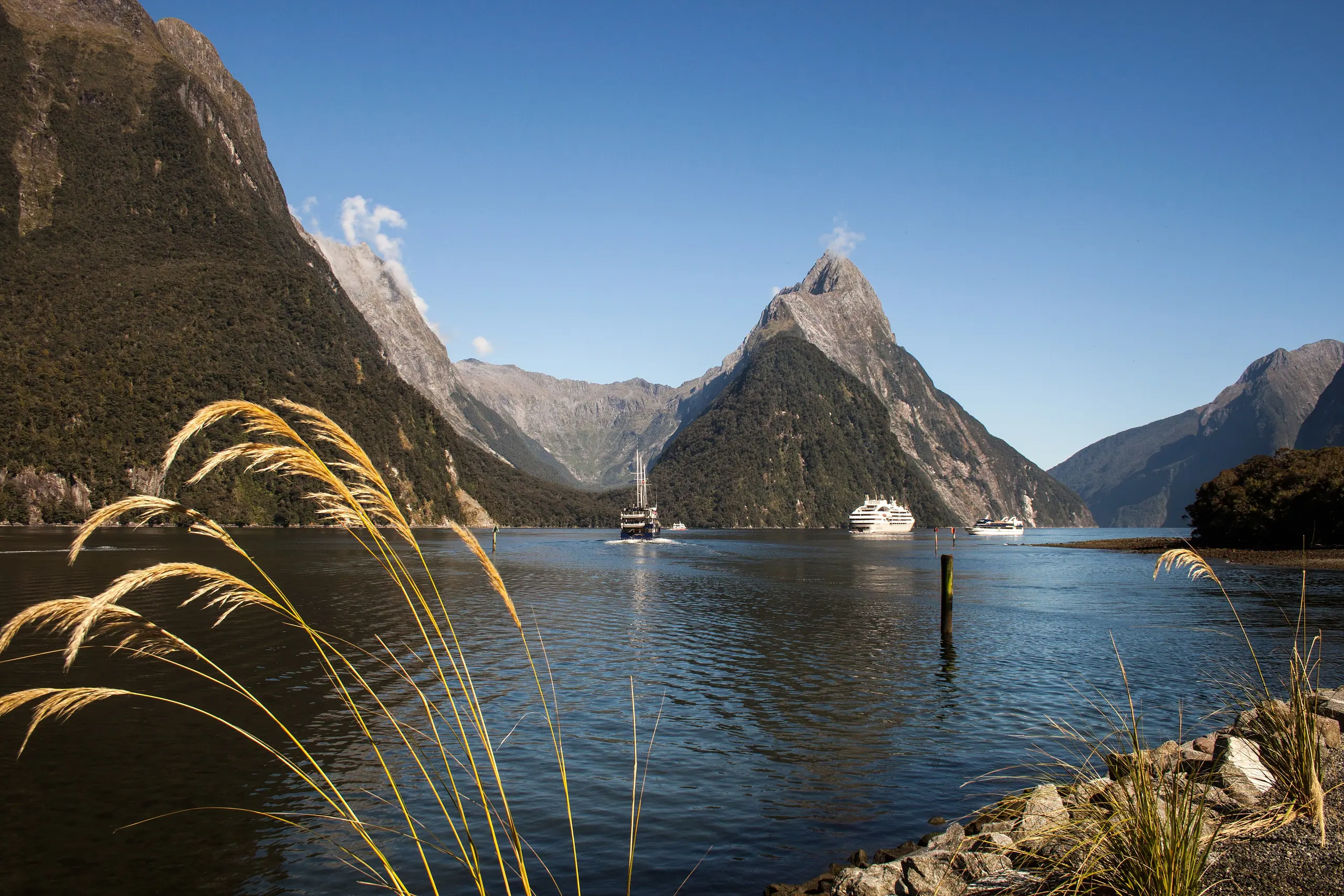
Mitre Peak and Milford Sound, just past the finish

Aotearoa · Land of the Long White Cloud

Walking the Long White Cloud

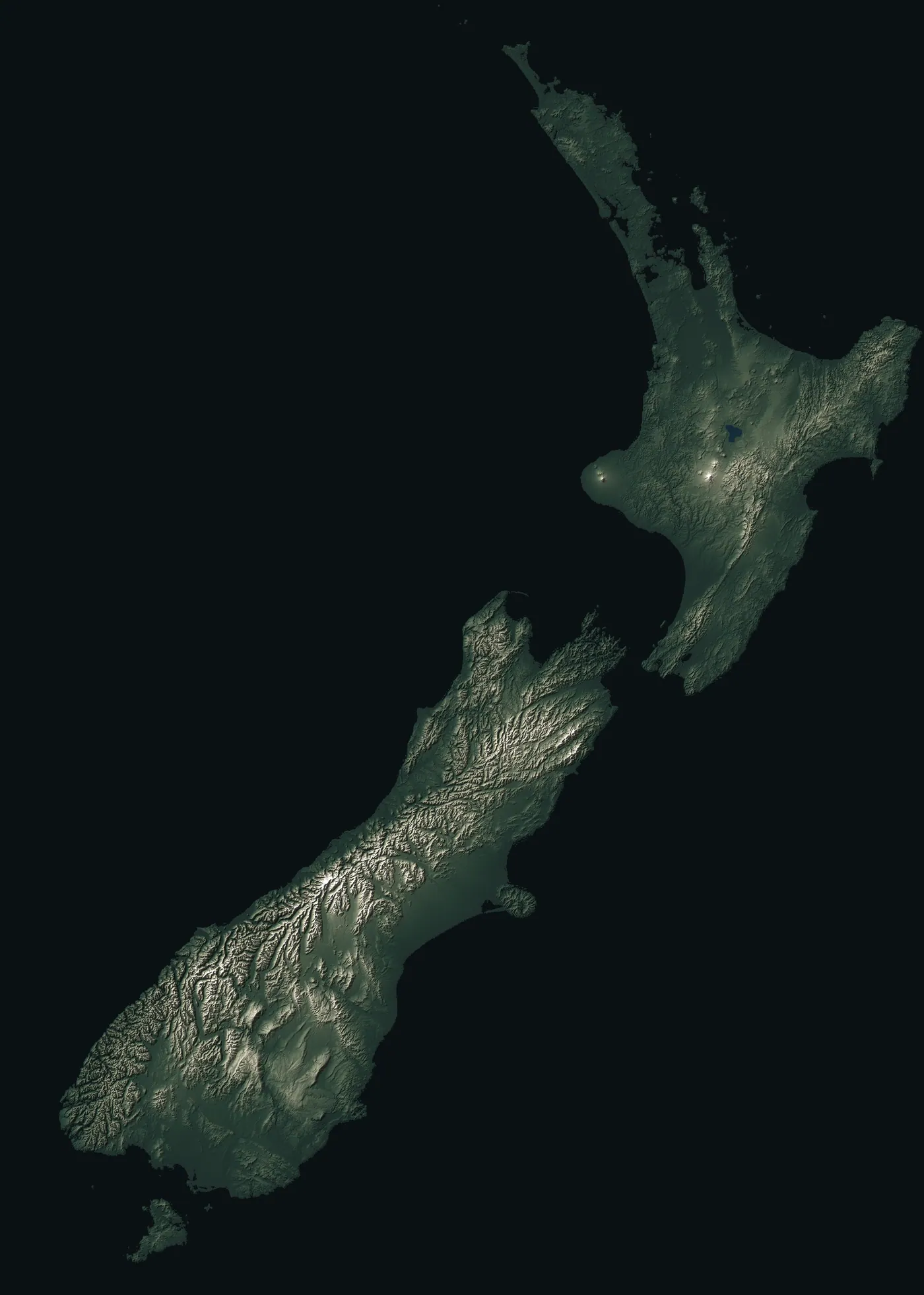
New Zealand’s 11 Great Walks, from north to south — then all on the same scale, so you can pick one.

Eleven tracks: three in the North Island, seven in the South, and one on the island at the very bottom.

Four of them are squeezed into Fiordland, and one is actually a paddle. Tap a name or a number on the map to jump there.

  1. 01 Lake Waikaremoana 46 km
  2. 02 Tongariro Northern Circuit 35.5 km
  3. 03 Whanganui Journey 145 or 88 km
  4. 04 Abel Tasman Coast Track 60 km
  5. 05 Heaphy Track 78.4 km
  6. 06 Paparoa Track 55 km
  7. 07 Routeburn Track 32 km
  8. 08 Milford Track 53.5 km
  9. 09 Kepler Track 60 km
  10. 10 Hump Ridge Track 60 km
  11. 11 Rakiura Track 32 km
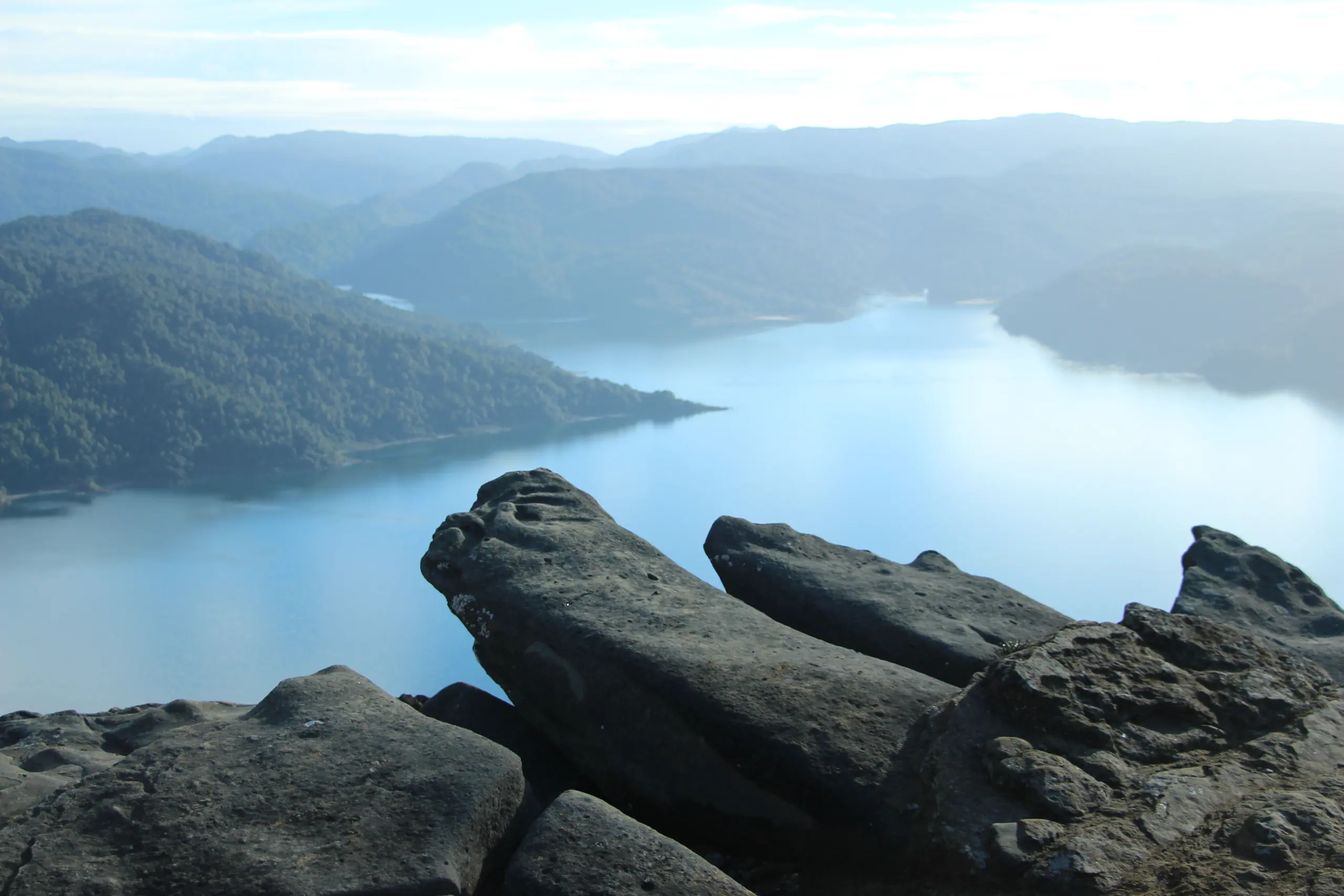
Lake Waikaremoana beyond a rocky foreground

01 / 11 · Te Urewera, eastern North Island

Lake Waikaremoana

Up onto the bluffs on day one, then along the lake edge through the rainforest.

  • 46 km
  • 3–4 days
  • One way

Te Urewera is Ngāi Tūhoe land, and New Zealand law recognises it as a legal person in its own right, with a board that speaks on its behalf. Tūhoe’s own organisations look after the track and huts. The walk climbs straight onto the Panekire bluffs, then drops down and follows the shoreline almost the whole way. It’s quiet and properly remote — just reaching the start means around 90 km of gravel road.

Distance
46 km
Duration
3–4 days
Route
One way
Total climb
about 1,470 m
High point
Puketapu Trig, 1,180 m
Season
Fees and bookings apply all year. The water taxis that link the two ends usually run from October to April and stop over winter.
Fees
Huts NZ$35, campsites NZ$19 (same for NZ residents and international visitors, per person per night)
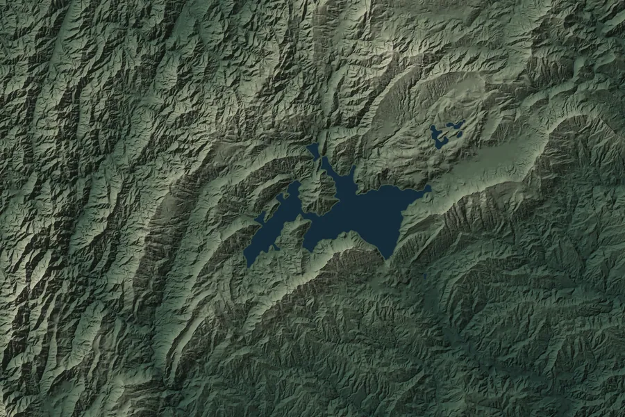
Relief map of the Lake Waikaremoana route S 1 2 3 4 5 6 7

Day by day

  1. 1 Onepoto → Panekire Hut 8.8 km 4–6 hr
  2. 2 Panekire Hut → Waiopaoa Hut 7.6 km 3–4 hr
  3. 3 Waiopaoa Hut → Korokoro Campsite 3.6 km 1.5 hr
  4. 4 Korokoro Campsite → Maraunui Campsite 6.8 km 2.5 hr
  5. 5 Maraunui Campsite → Marauiti Hut 1.7 km 30 min
  6. 6 Marauiti Hut → Waiharuru Hut 6.2 km 2 hr
  7. 7 Waiharuru Hut → Hopuruahine Landing 9.5 km 4.5 hr

Officially 46 km; the sections add up to about 44 km.

Elevation profile

Move across the chart and the map follows along

1,175 m 582 m 1 2 3 4 5 6 7
0 47.1 km (measured along the track)

Where to stay

Four huts (Panekire, Waiopaoa, Marauiti and Waiharuru) and five campsites, all of which must be booked ahead. The huts have no gas cookers or lighting. Whanganui Hut is closed.

Getting there

The track runs from Onepoto to Hopuruahine Landing, about 20 and 30 minutes’ drive from Te Karetu respectively. The Hopuruahine road currently isn’t suitable for 2WD vehicles. Since it’s one way, book a water taxi or shuttle in advance.

Don’t miss

  • The whole lake laid out below the Panekire bluffs
  • Korokoro Falls dropping off a cliff into the forest
  • The Puketukutuku Peninsula and its sheltered bays to camp in

Watch out for

  • The Panekire ridge is roughly 600 m up and 600 m down, possibly under a 15 kg pack.
  • The water tank at Panekire Hut can run dry in summer.
  • The weather turns fast — it can snow even in summer.
  • Not recommended for children under 10.
DOC track page ↗

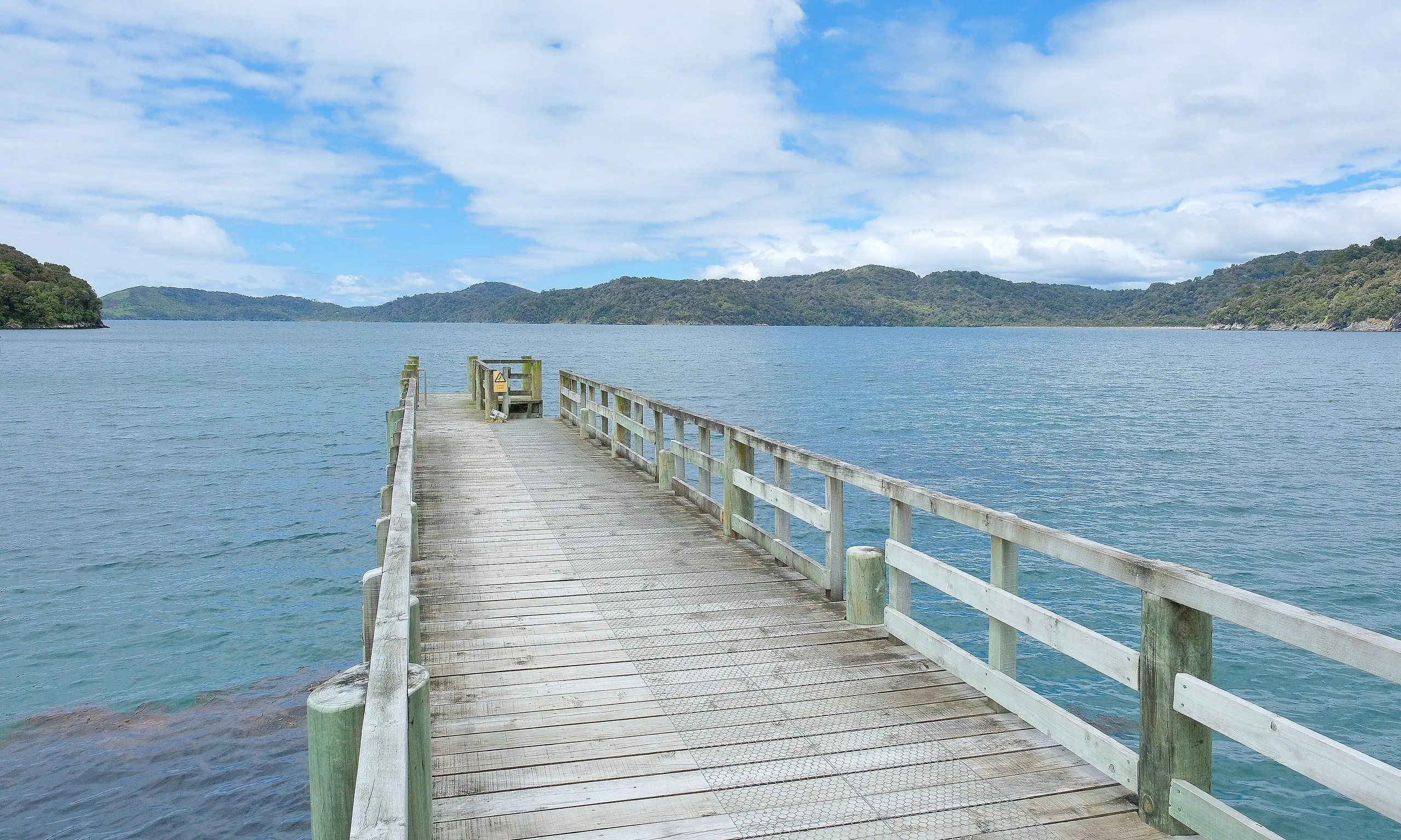
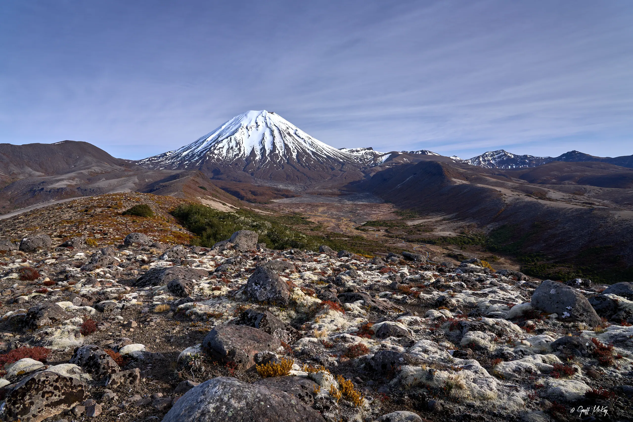
Ngauruhoe after fresh snow, lava in the foreground

02 / 11 · Tongariro National Park, central North Island

Tongariro Northern Circuit

Black lava, a red crater and lakes the colour of emeralds.

  • 35.5 km (this season)
  • 3–4 days
  • One way this season

This is the one that feels most like another planet. The black lava from Ngauruhoe’s 1949 and 1954 eruptions still looks fresh, and once you’re over Red Crater the Emerald Lakes open up below you. Tongariro was New Zealand’s first national park, and its summits are sacred to Ngāti Tūwharetoa — so please leave the tops of Ngauruhoe and Tongariro unclimbed.

Distance
35.5 km (this season)
Duration
3–4 days
Route
One way this season
Total climb
about 1,210 m
High point
About 1,860 m (around Red Crater, from the elevation model)
Season
23 October 2026 to 30 April 2027. Outside the season there’s snow and avalanche risk, worst from July to October.
Fees
NZ residents NZ$44, international visitors NZ$66 (per person per night)

This season After the 2025 fire, the Whakapapa to Mangatepopo Hut section is closed for the 2026/27 season. The route is now one way from Mangatepopo car park to Whakapapa, shortened to 35.5 km. DOC also notes that Oturere Hut is being replaced, so check the latest before you go.

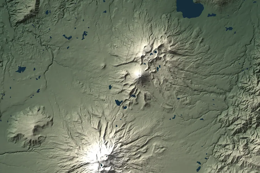
Relief map of the Tongariro Northern Circuit route S 1 2 3 4 5

Day by day

  1. 1 Mangatepopo car park → Mangatepopo Hut 1.7 km 25 min
  2. 2 Mangatepopo Hut → Emerald Lakes 8 km 3.5 hr
  3. 3 Emerald Lakes → Oturere Hut 4 km 1.5 hr
  4. 4 Oturere Hut → Waihohonu Hut 8.1 km 3 hr
  5. 5 Waihohonu Hut → Whakapapa Village 15.4 km 5 hr

Officially 35.5 km; the sections add up to about 37 km.

Elevation profile

Move across the chart and the map follows along

1,860 m 1,099 m 1 2 3 4 5
0 36.6 km (measured along the track)

Where to stay

Three huts — Mangatepopo, Oturere and Waihohonu — each with a campsite alongside. The huts have basic gas cookers, but no utensils or food.

Getting there

In peak season the Mangatepopo car park has a 4-hour limit, so DOC suggests leaving your car at Whakapapa Village and taking a shuttle. Overnight parking needs a free permit from the visitor centre. Buses and the train stop at National Park Village, 15 km from Whakapapa.

Don’t miss

  • Red Crater and the Emerald Lakes
  • Ngauruhoe’s young lava flows
  • The Oturere Valley and the Rangipo Desert
  • Tama Lakes and Ohinepango Springs (side trips)

Watch out for

  • Mangatepopo to Emerald Lakes is the most exposed alpine stretch of the whole track.
  • Outside the Great Walk season you’ll need alpine skills and gear.

DOC track page ↗

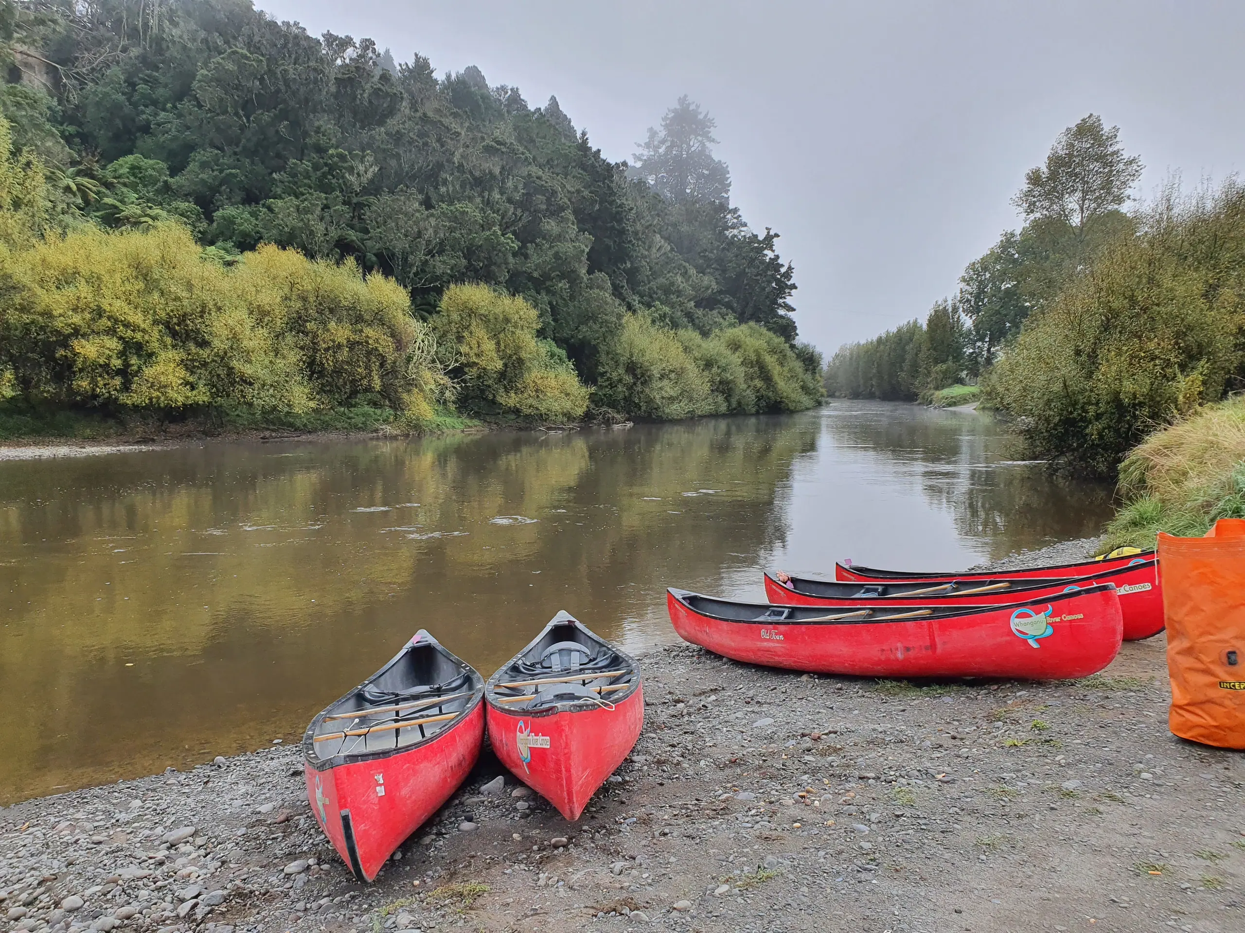
Red canoes on a riverbank

03 / 11 · Whanganui National Park, south-western North Island

Whanganui Journey

The only one of the eleven you don’t walk — you paddle the whole way.

  • 145 or 88 km
  • 3–5 days
  • One way, downriver

Pack a paddle for this Great Walk. In law, the Whanganui River is a living whole called Te Awa Tupua, and every bend has its guardians. Over three to five days you drift from Taumarunui down to Pipiriki between mudstone cliffs and ancient forest, with time to pull ashore and walk to the Bridge to Nowhere, then spend a night at Tīeke Kāinga, a marae that is still in use.

Distance
145 or 88 km
Duration
3–5 days
Route
One way, downriver
Total climb
All downstream
High point
No climbing — the river drops about 120 m (from the elevation model)
Season
Bookings needed from 1 October to 30 April. From May to September it’s first come, first served; the water is cold and high, and only very experienced paddlers should go.
Fees
Huts NZ$35, campsites NZ$19 (same for NZ residents and international visitors, per person per night)
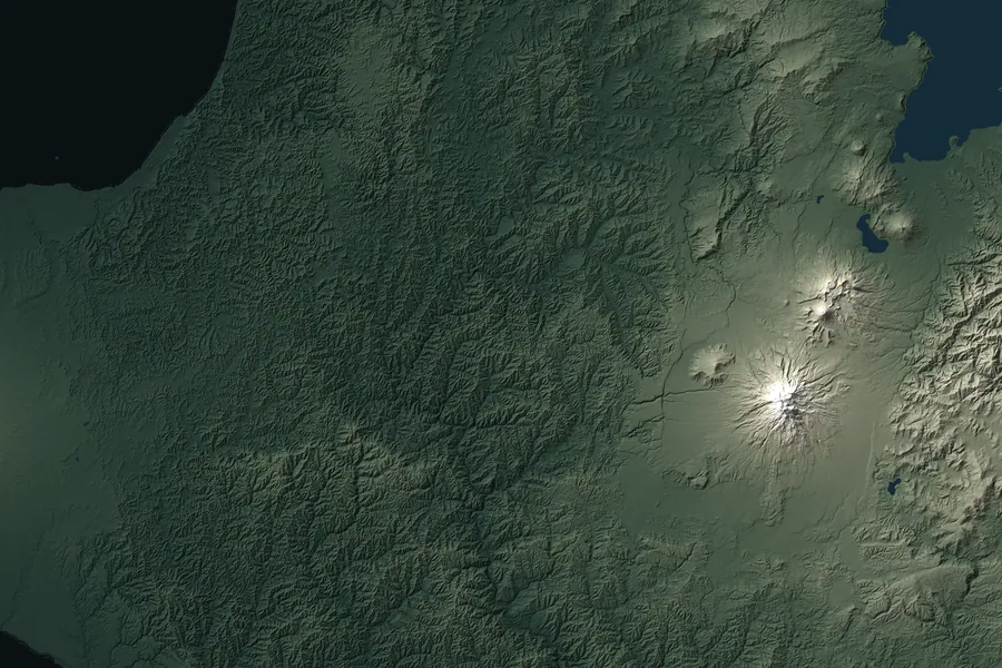
Relief map of the Whanganui Journey route S 1 2 3 4 5

Day by day

  1. 1 Ngāhuinga (Cherry Grove) → Ohinepane Campsite 22 km 3–5 hr
  2. 2 Ohinepane Campsite → Whakahoro 35 km 6–8 hr
  3. 3 Whakahoro → John Coull Hut 37.5 km 7–9 hr
  4. 4 John Coull Hut → Tīeke Kāinga 29 km 7–9 hr
  5. 5 Tīeke Kāinga → Pipiriki 21.5 km 4–6 hr

The popular shorter trip starts at Whakahoro and finishes at Pipiriki: 88 km, about 3 days.

River level

Move across the chart and the map follows along

163 m 40 m 1 2 3 4 5
0 150.3 km (measured along the track)

Where to stay

John Coull Hut, Tīeke Kāinga (a hut and marae — please follow local tikanga), the Whakahoro Bunkroom, and campsites along the river. The huts have no heating, wardens or firewood.

Getting there

The full journey starts at Taumarunui; the shorter one puts in at Whakahoro, at the end of about 43 km of narrow, winding road. Both finish at Pipiriki. Operators in the nearby towns hire out canoes, life jackets and waterproof barrels as a package, with transport.

Don’t miss

  • Landing at Mangapurua to walk to the Bridge to Nowhere
  • Sheer mudstone gorges and waterfalls
  • Brown kiwi calling at night

Watch out for

  • Don’t launch when the river is in flood or rising.
  • Without a guide you need to be a confident swimmer and paddler, good for 6–7 hours a day.
  • Expect jet boats in the rapids — keep right and give way.
  • Wasps are common from January to May, there’s no phone coverage, and alcohol is banned.

DOC track page ↗

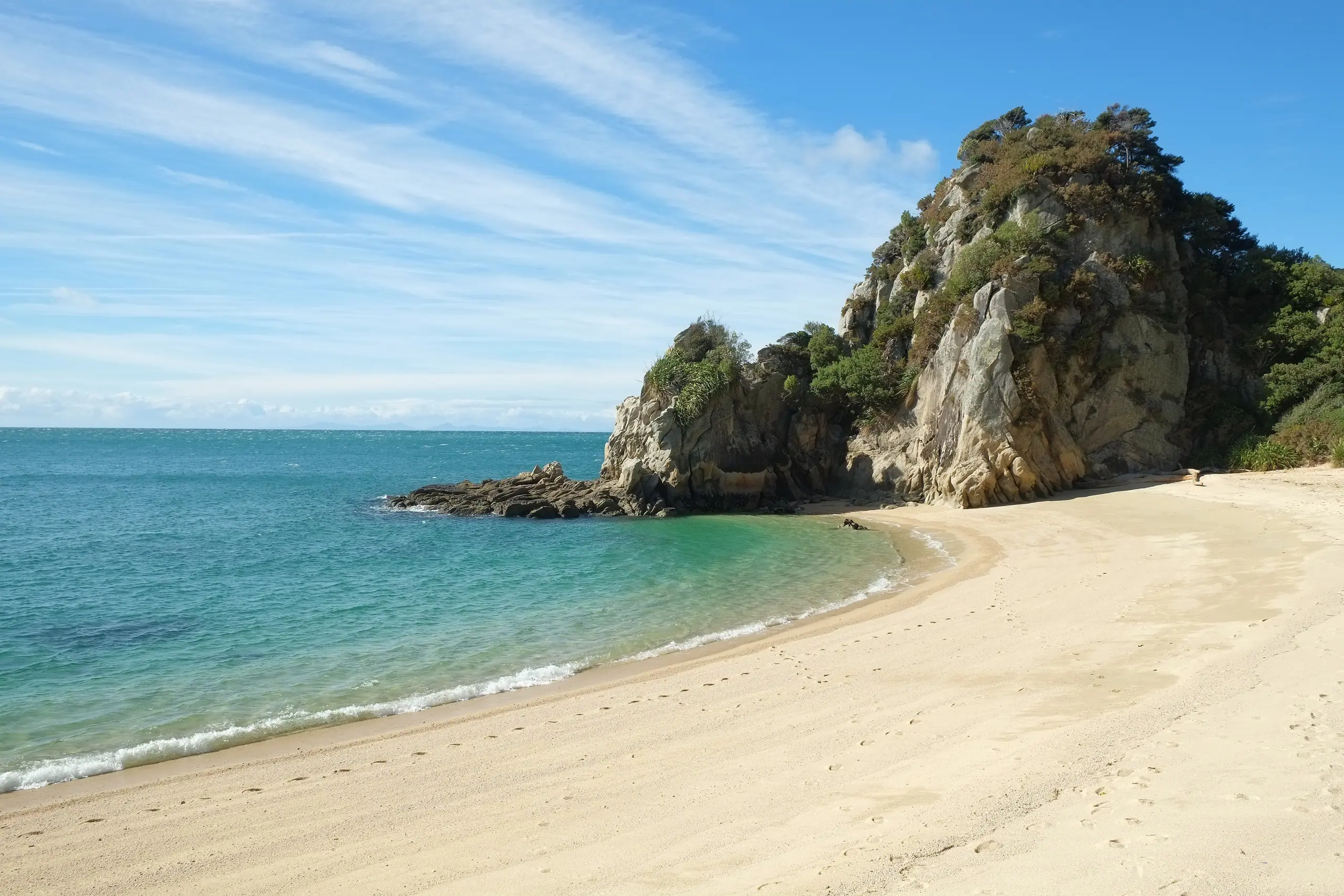
A cove north of Anapai Bay

04 / 11 · Abel Tasman National Park, north-western South Island

Abel Tasman Coast Track

Golden sand, turquoise water, and a water taxi for when your legs have had enough.

  • 60 km
  • 3–5 days
  • One way

The most relaxed of the lot: open all year, never higher than 200 m, and every day ends at a beach. Water taxis call at several bays, so you can walk just one section, and sending your pack ahead by boat is common. What you really need to plan around isn’t fitness — it’s the tide.

Distance
60 km
Duration
3–5 days
Route
One way
Total climb
about 1,380 m
High point
About 190 m (from the elevation model)
Season
Open and bookable all year. Busiest from October to April; two nights maximum at any one hut or campsite.
Fees
Huts: NZ residents NZ$55, international visitors NZ$84 (1 Oct–30 Apr, per person per night). NZ$33–42 the rest of the year.
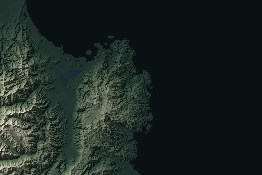
Relief map of the Abel Tasman Coast Track route S 1 2 3 4 5 6

Day by day

  1. 1 Marahau → Anchorage 12.4 km 4 hr
  2. 2 Anchorage → Bark Bay 11.5 km 4 hr (3 hr by the low-tide route)
  3. 3 Bark Bay → Awaroa 13.5 km 4.5 hr
  4. 4 Awaroa → Tōtaranui 7.1 km 2 hr 20 min
  5. 5 Tōtaranui → Whariwharangi Bay 9.8 km 3 hr 15 min
  6. 6 Whariwharangi Bay → Wainui 5.7 km 2 hr

Elevation profile

Move across the chart and the map follows along

189 m 2 m 1 2 3 4 5 6
0 62.9 km (measured along the track)

Where to stay

Four huts (Anchorage, Bark Bay, Awaroa and Whariwharangi — the last a converted homestead from around 1896) and 18 campsites.

Getting there

The southern end, Marahau, is 67 km from Nelson; the northern end, Wainui, is 21 km from Takaka. Water taxis run year-round between Marahau, Kaiteriteri and Tōtaranui. Book ahead, and note they don’t go north of Tōtaranui.

Don’t miss

  • Cleopatra’s Pool, a natural rock pool
  • The 47 m swing bridge over Falls River
  • The long beach at Onetahuti
  • Tonga Island Marine Reserve and its seals

Watch out for

  • Awaroa Inlet can only be crossed in daylight, from 1.5 hours before to 2 hours after low tide. There’s no way around it.
  • The Torrent Bay and Bark Bay estuaries can only be crossed within 2 hours either side of low tide; otherwise take the all-tide track.
  • Boil water before drinking. Wasps and sandflies in summer.
  • After a strong earthquake or a sudden change in the sea, head for high ground straight away.

DOC track page ↗

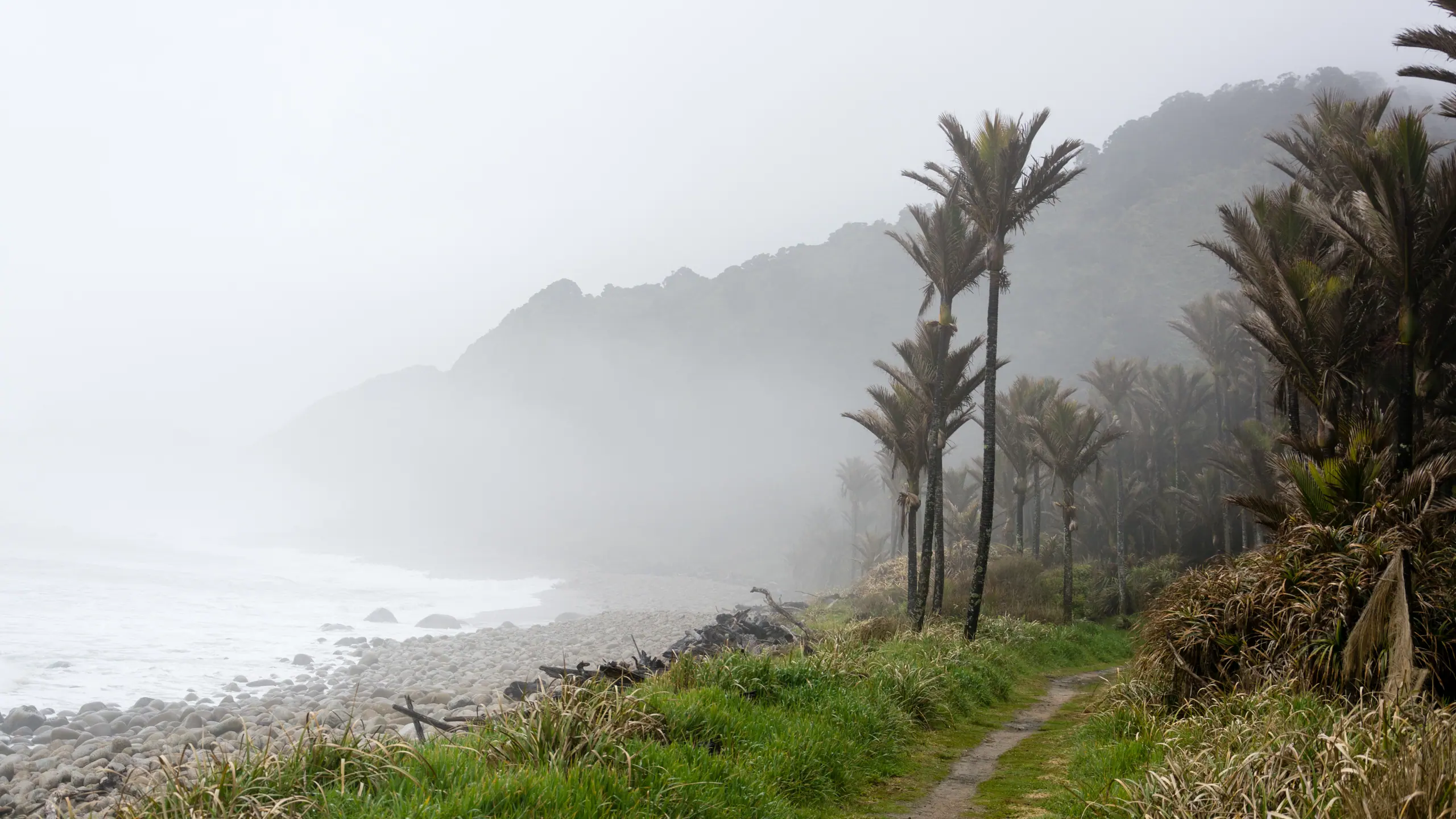
The nīkau coast in sea mist

05 / 11 · Kahurangi National Park, north-western South Island

Heaphy Track

From high tussock country down to a coast of nīkau palms — the longest walk of them all.

  • 78.4 km
  • 2–6 days
  • One way

The longest of the Great Walks on foot, and the one with the most changes of scene: up through beech forest, over Perry Saddle onto the open tussock of the Gouland Downs, down through limestone country and river valleys, and finally along a wild West Coast fringed with nīkau palms. In winter it opens to mountain bikers too.

Distance
78.4 km
Duration
2–6 days
Route
One way
Total climb
about 1,280 m
High point
Flanagans Corner, 915 m
Season
Bookings needed all year. Mountain biking only from 1 May to 30 November.
Fees
Huts: NZ residents NZ$44, international visitors NZ$66 (1 Oct–30 Apr, per person per night). NZ$30–38 the rest of the year.
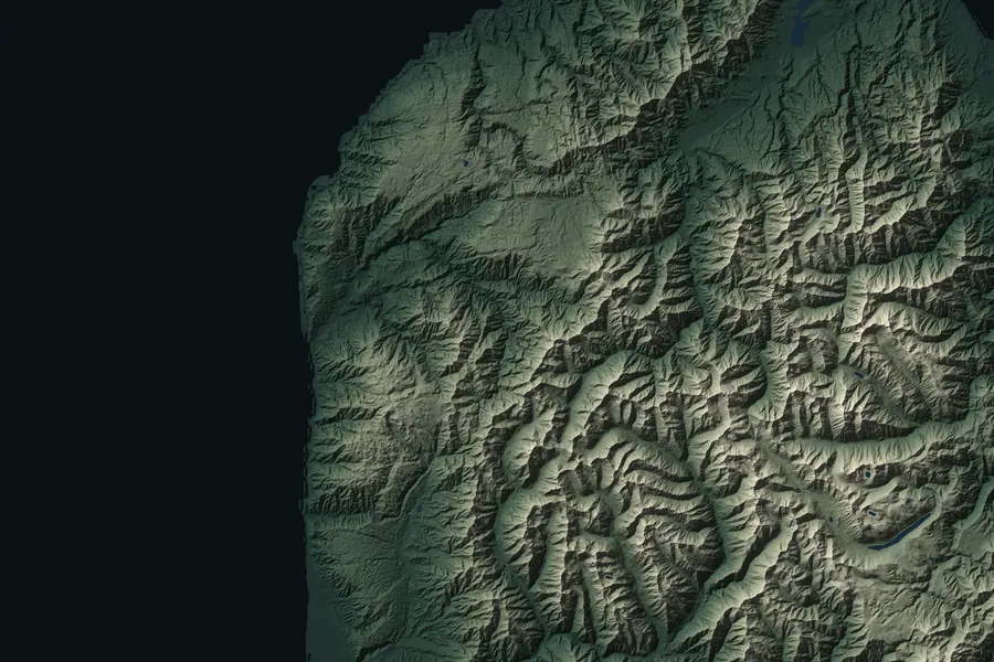
Relief map of the Heaphy Track route S 1 2 3 4 5 6

Day by day

  1. 1 Brown Hut → Perry Saddle Hut 17.5 km 5 hr
  2. 2 Perry Saddle Hut → Gouland Downs Hut 7 km 2 hr
  3. 3 Gouland Downs Hut → Saxon Hut 5.4 km 1.5 hr
  4. 4 Saxon Hut → James Mackay Hut 11.8 km 3 hr
  5. 5 James Mackay Hut → Heaphy Hut 20.5 km 6 hr
  6. 6 Heaphy Hut → Kohaihai 16.2 km 5 hr

Walkers usually take 4–6 days. For mountain bikers it’s a Grade 4 (advanced) ride, usually 2–3 days.

Elevation profile

Move across the chart and the map follows along

939 m 6 m 1 2 3 4 5 6
0 73.2 km (measured along the track)

Where to stay

Six huts (Brown, Perry Saddle, Gouland Downs, Saxon, James Mackay and Heaphy) and about 10 campsites. Lewis Shelter is for emergencies only — no overnight stays.

Getting there

Brown Hut, at the eastern end, is 156 km from Nelson; Kohaihai, at the western end, is 110 km from Westport. The two ends are a very long drive apart, so many people fly back over in a small plane afterwards or arrange a car relocation.

Don’t miss

  • The Gouland Downs
  • Limestone arches, caves and Cave Stream
  • Big surf at the Heaphy River mouth
  • The nīkau palm coast

Watch out for

  • The coastal section from Heaphy Hut to Kohaihai can be impassable at high tide or in big seas.
  • Between Lewis Shelter and Heaphy Hut the track floods easily.
  • Phone coverage is rare — only a few spots.

DOC track page ↗

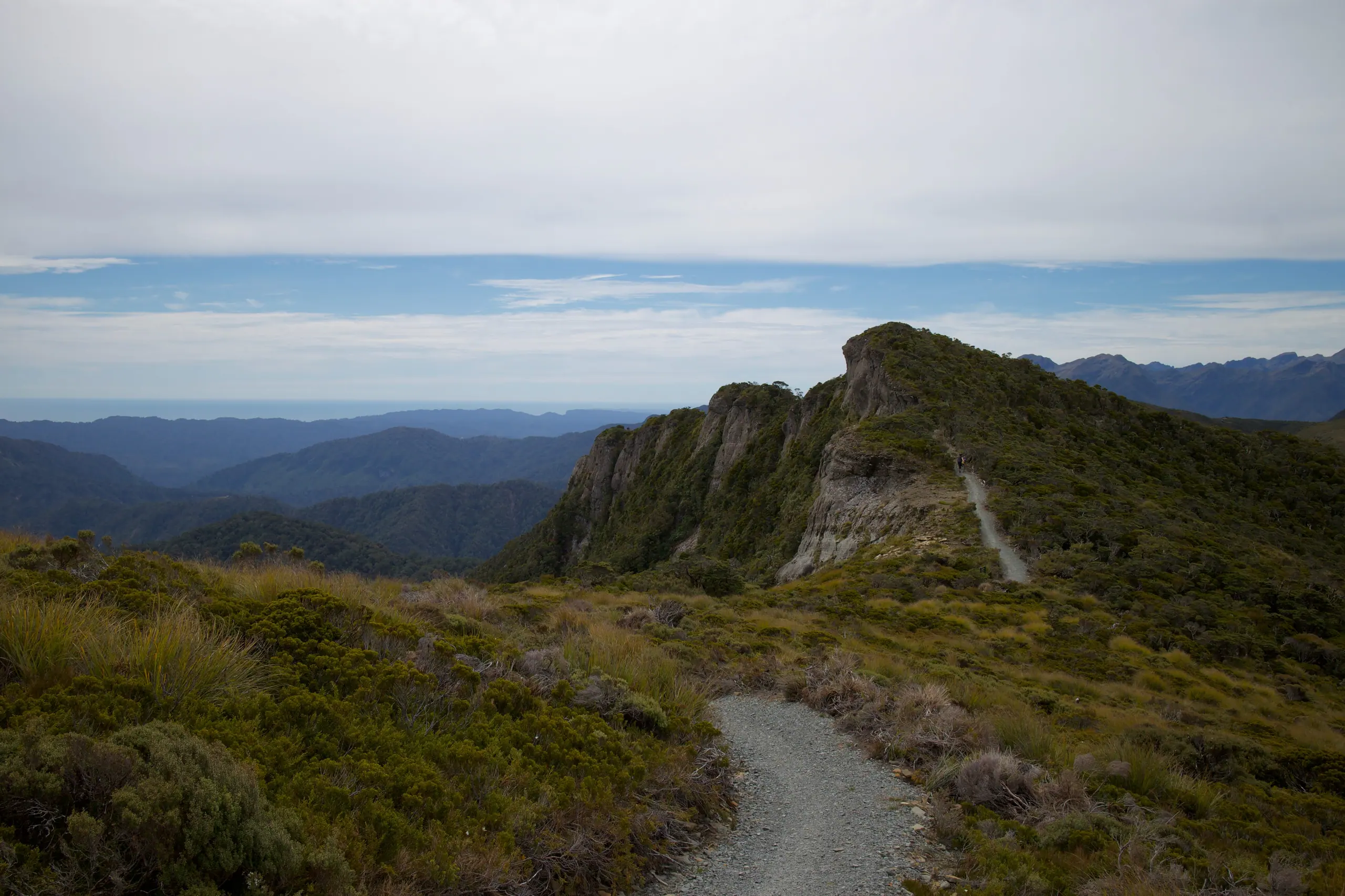
The track running out to the end of the ridge

06 / 11 · Paparoa National Park, South Island West Coast

Paparoa Track

A track built in memory of 29 miners.

  • 55 km
  • 2–3 days
  • One way

On 19 November 2010, an explosion at the Pike River Mine killed 29 men. Their families, together with DOC and Ngāti Waewae, pushed for this track as both a memorial and a thank-you to the New Zealanders who stood by them. It follows old gold-miners’ trails up to the ridge, watches the sun go down over the Tasman Sea from Moonlight Tops, and finishes through the nīkau palms of the Pororari gorge on the way to the sea.

Distance
55 km
Duration
2–3 days
Route
One way
Total climb
about 1,470 m
High point
About 1,140 m on the main track (from the elevation model); Croesus Knob side trip 1,204 m
Season
Fees and bookings apply all year, with peak rates from October to April. About 3 days on foot, 2 by mountain bike.
Fees
Varies by hut. 1 Oct–30 Apr: NZ residents NZ$50–78, international visitors NZ$76–117 (per person per night).
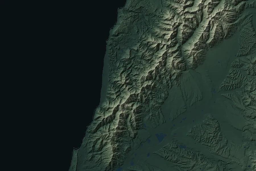
Relief map of the Paparoa Track route S 1 2 3 4

Day by day

  1. 1 Smoke-ho car park → Ces Clark Hut 10.3 km 4–5 hr
  2. 2 Ces Clark Hut → Moonlight Tops Hut 9.7 km 3 hr
  3. 3 Moonlight Tops Hut → Pororari Hut 19.1 km 5–7 hr
  4. 4 Pororari Hut → Pororari River car park 16 km 4–5 hr

Mountain bikers exit via the Waikori Road car park, 56.2 km in total. No e-bikes and no riding after dark.

Elevation profile

Move across the chart and the map follows along

1,140 m 19 m 1 2 3 4
0 51.3 km (measured along the track)

Where to stay

Three huts — Ces Clark, Moonlight Tops and Pororari — with heating and gas cookers, but the bunkrooms aren’t heated, so bring warm layers.

Getting there

The start, Smoke-ho car park, is 8 km north of Blackball. Parking is daytime only and camping isn’t allowed, so stay nearby the night before. The track finishes right by the Pancake Rocks at Punakaiki. Shuttles serve both ends, and DOC recommends leaving your car where you’re staying.

Don’t miss

  • Sunset from Moonlight Tops
  • The Croesus gold trail, in use from 1881 to 1899
  • Nīkau palms in the Pororari gorge
  • The Lone Hand rock pinnacle

Watch out for

  • Don’t try to walk from Ces Clark to Pororari in one day: it’s 28.8 km, about 10 hours.
  • In heavy rain or strong wind, stay at Pororari Hut rather than heading for the car park.
  • Most of the track has no coverage, and there have been thefts from the car parks.

DOC track page ↗

Cloud spilling over the Hollyford Valley

07 / 11 · Fiordland and Mount Aspiring national parks, south-western South Island

Routeburn Track

The shortest alpine route, with half the walk above the bushline.

  • 32 km
  • 2–4 days
  • One way

At 32 km it’s the same length as the Rakiura Track, but it feels like a different world. You climb from beech forest and river flats to Harris Saddle, then traverse the Hollyford Face with the whole valley falling away beneath you, before dropping down to the green waters of Lake Mackenzie. The two ends are 325 km apart by road, so the logistics need more planning than your legs do.

Distance
32 km
Duration
2–4 days
Route
One way
Total climb
about 1,240 m
High point
Harris Saddle / Tarahaka Whakatipu, 1,255 m
Season
1 November 2026 to 30 April 2027. Outside the season it isn’t run as a Great Walk: there’s avalanche risk, and some bridges and facilities are removed.
Fees
NZ residents NZ$88, international visitors NZ$132 (per person per night)
Relief map of the Routeburn Track route S 1 2 3 4

Day by day

  1. 1 Routeburn Shelter → Routeburn Flats Hut 7.5 km 1.5–2.5 hr
  2. 2 Routeburn Flats Hut → Routeburn Falls Hut 2.3 km 1–1.5 hr
  3. 3 Routeburn Falls Hut → Lake Mackenzie Hut 11.3 km 4.5–6 hr
  4. 4 Lake Mackenzie Hut → The Divide 12 km 4–5.5 hr

Officially 32 km; the sections add up to about 33 km. You can start from either end.

Elevation profile

Move across the chart and the map follows along

1,286 m 476 m 1 2 3 4
0 31.5 km (measured along the track)

Where to stay

Three huts — Routeburn Flats, Routeburn Falls and Lake Mackenzie — plus campsites. Lake Howden Hut was destroyed in a storm in February 2020.

Getting there

Routeburn Shelter, at one end, is 25 km from Glenorchy; The Divide, at the other, is 85 km from Te Anau. By road the two ends are 325 km apart, so book transport well ahead.

Don’t miss

  • Harris Saddle and Conical Hill (1.5–2 hr return)
  • Earland Falls, 174 m high
  • The alpine wetlands of Key Summit (1–1.5 hr return)
  • The traverse across the Hollyford Face

Watch out for

  • Even in season, sections can close at short notice because of avalanche risk.
  • Outside the season there’s snow, avalanche danger and cold — for experienced trampers only.

DOC track page ↗

The rocky climb over Mackinnon Pass

08 / 11 · Fiordland National Park, south-western South Island

Milford Track

The most famous of them all — and the hardest to get a booking for.

  • 53.5 km
  • 4 days
  • One way, one direction only

You arrive by boat and leave by boat, and in between you walk it in one direction only: three nights, four days. The first two days follow the glacier-carved Clinton Valley; on day three you cross Omanui/McKinnon Pass and take the side trip to the 580 m Sutherland Falls. Up to 9,000 mm of rain can fall here in a year, so rain is the norm — and when it rains, every rock face turns into a waterfall.

Distance
53.5 km
Duration
4 days
Route
One way, one direction only
Total climb
about 950 m
High point
Omanui/McKinnon Pass Shelter, 1,154 m
Season
1 November 2026 to 30 April 2027; last departure 28 April.
Fees
NZ residents NZ$106, international visitors NZ$152 (per person per night)
Relief map of the Milford Track route S 1 2 3 4

Day by day

  1. 1 Glade Wharf → Clinton Hut 5 km 1–1.5 hr
  2. 2 Clinton Hut → Mintaro Hut 17.5 km 6 hr
  3. 3 Mintaro Hut → Dumpling Hut 13 km 6–7 hr
  4. 4 Dumpling Hut → Sandfly Point 18 km 5.5–6 hr

Elevation profile

Move across the chart and the map follows along

1,136 m 6 m 1 2 3 4
0 53.6 km (measured along the track)

Where to stay

Three huts — Clinton, Mintaro and Dumpling — stayed in on consecutive nights. It can only be done as 3 nights, 4 days.

Getting there

From Te Anau, take a bus to Te Anau Downs (about 30 minutes), then a boat to Glade Wharf (about 1 hour 15 minutes). At the far end, a 20-minute boat ride takes you from Sandfly Point to Milford Sound. Neither end has road access, so book transport in advance.

Don’t miss

  • Omanui/McKinnon Pass
  • Sutherland Falls, 580 m (about 1.5 hr return)
  • The Clinton Valley
  • Mackay Falls and Lake Ada

Watch out for

  • In heavy rain the Clinton and Arthur valleys can flood, and slips are common.
  • Outside the season there are more than 57 avalanche paths, and bridges are removed.
  • No phone coverage anywhere on the track.
  • Not recommended for children under 10.
DOC track page ↗

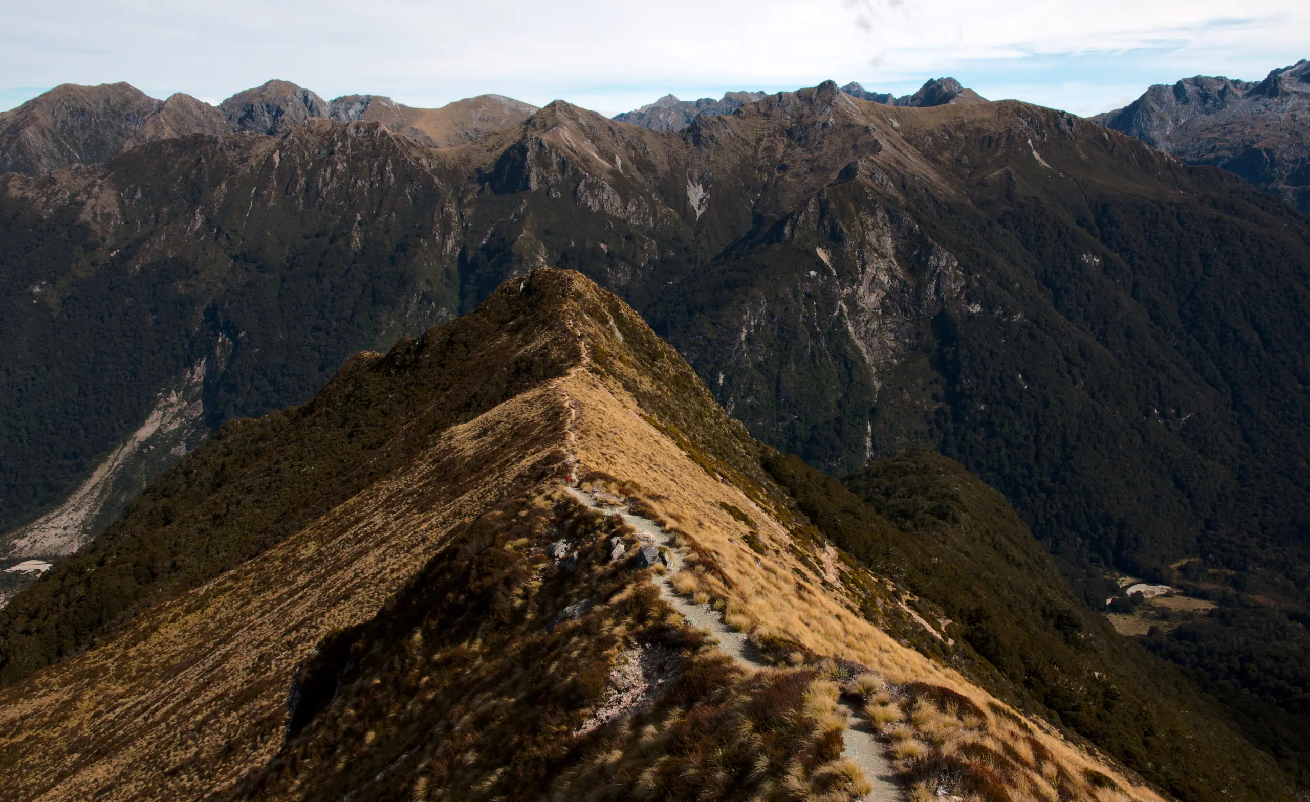
A narrow alpine ridge

09 / 11 · Fiordland National Park, south-western South Island

Kepler Track

An alpine loop you can start by walking out the door in Te Anau.

  • 60 km
  • 3–4 days
  • Loop

No transport to book: from Te Anau township it’s about 50 minutes’ walk around the lake to the start. Day one climbs through beech forest and past limestone bluffs to Luxmore Hut; day two is spent entirely above the bushline on an alpine ridge, with Lake Te Anau on one side and Lake Manapouri on the other — and, with luck, a mischievous kea or two for company.

Distance
60 km
Duration
3–4 days
Route
Loop
Total climb
about 1,580 m
High point
Luxmore summit 1,472 m (side trip); about 1,400 m on the main track
Season
27 October 2026 to 30 April 2027. Outside the season only Luxmore Hut can be booked.
Fees
NZ residents NZ$88, international visitors NZ$132 (per person per night)
Relief map of the Kepler Track route S 1 2 3 4 5 6

Day by day

  1. 1 Kepler car park → Brod Bay 5.6 km 1.5 hr
  2. 2 Brod Bay → Luxmore Hut 8.2 km 3.5–4.5 hr
  3. 3 Luxmore Hut → Iris Burn Hut 14.6 km 5–6 hr
  4. 4 Iris Burn Hut → Moturau Hut 16.2 km 5–6 hr
  5. 5 Moturau Hut → Rainbow Reach 6 km 1.5–2 hr
  6. 6 Rainbow Reach → Kepler car park 9.5 km 2.5–3.5 hr

Most people take 3 nights, 4 days. You can also catch a shuttle back to Te Anau from Rainbow Reach.

Elevation profile

Move across the chart and the map follows along

1,396 m 181 m 1 2 3 4 5 6
0 57.1 km (measured along the track)

Where to stay

Three huts — Luxmore, Iris Burn and Moturau — with campsites at Brod Bay and Iris Burn. The Forest Burn and Hanging Valley shelters aren’t for overnight stays.

Getting there

The car park is about 5 km from Te Anau, roughly 50 minutes’ walk along the lake from the visitor centre. In season there are daily shuttles to the start and to Rainbow Reach, and a scheduled boat to Brod Bay.

Don’t miss

  • Luxmore Cave and the summit side trip
  • The alpine ridge section
  • Lakes Te Anau and Manapouri
  • The Iris Burn valley

Watch out for

  • Fill up with water before leaving Luxmore Hut — there’s no reliable source until Iris Burn Hut.
  • Even in season, the alpine section can close because of avalanche risk.
  • Kea may wreck unattended packs and boots.

DOC track page ↗

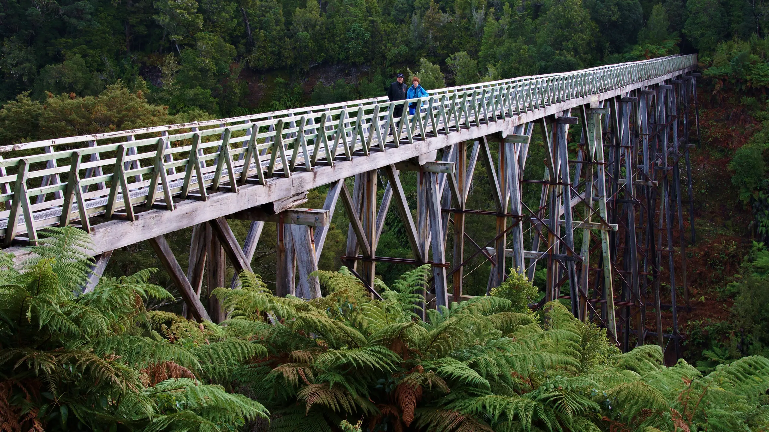
The Percy Burn Viaduct

10 / 11 · Southern Fiordland, near Tuatapere

Hump Ridge Track

The newest Great Walk, where you sleep in mountain lodges.

  • 60 km (operator says 61 km)
  • 3 days
  • Loop

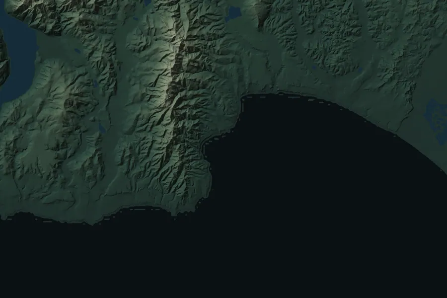
It only became the eleventh Great Walk on 25 October 2024, and it’s run by a local community trust. Day one climbs from the coast to a subalpine ridge; day two follows an old logging tramway through the forest and over century-old timber viaducts; day three heads home along Te Waewae Bay. The days are long, but the nights are spent in comfortable lodges.

Distance
60 km (operator says 61 km)
Duration
3 days
Route
Loop
Total climb
about 1,400 m
High point
About 920 m (from the elevation model)
Season
23 October 2026 to 17 April 2027; closed in winter.
Fees
No per-night fee: independent packages from NZ$495 per person, including accommodation, booked through the Hump Ridge Trust.

This season The operator advises that the Percy Burn and Edwin Burn viaducts are currently closed, with a detour in place. The viaduct photos in the gallery were taken before the closure.

Relief map of the Hump Ridge Track route S 1 2 3

Day by day

  1. 1 Rarakau car park → Ōkaka Lodge 20.6 km 7–9 hr
  2. 2 Ōkaka Lodge → Port Craig Lodge 20.7 km 7–9 hr
  3. 3 Port Craig Lodge → Rarakau car park 20.2 km 5–7 hr

DOC’s comparison page says 60 km; the sections add up to about 61.5 km.

Elevation profile

Move across the chart and the map follows along

922 m 4 m 1 2 3
0 57.9 km (measured along the track)

Where to stay

Ōkaka Lodge and Port Craig Lodge, with better facilities than the other Great Walk huts.

Getting there

The start, Rarakau car park, is near Tuatapere: about 1 hour 15 minutes from Invercargill Airport, 1.5 hours from Te Anau and 2.5 hours from Queenstown. The track office arranges transport, and there are helicopter and jet boat options too.

Don’t miss

  • Rock tors and tarns around Ōkaka
  • The old sawmill and wharf ruins at Port Craig
  • Te Waewae Bay
  • Blowholes Beach (passable at low tide only)

Watch out for

  • Days one and two are both long: about 20 km and 7–9 hours each.
  • Blowholes Beach can only be crossed at low tide.
  • The ridge section is fairly exposed.

Hump Ridge Track website ↗

Port William wharf

11 / 11 · Stewart Island / Rakiura

Rakiura Track

Cross the strait by boat and walk a loop on the southernmost island.

  • 32 km
  • 3 days
  • Loop

The southernmost of the Great Walks, and the quietest underfoot. Take the hour-long ferry or a 20-minute flight across, set off from Oban — the island’s only town — and follow the coast past Maori Beach before heading into podocarp forest and round to Paterson Inlet. Along the way you’ll pass rusting sawmill machinery, and at night you might even meet a wild Rakiura tokoeka, the Stewart Island kiwi.

Distance
32 km
Duration
3 days
Route
Loop
Total climb
about 760 m
High point
About 180 m (from the elevation model)
Season
Open and bookable all year; two nights maximum at each hut or campsite.
Fees
Huts: NZ residents NZ$44, international visitors NZ$66 (1 Oct–30 Apr, per person per night). NZ$31–38 the rest of the year.
Relief map of the Rakiura Track route S 1 2 3 4 5

Day by day

  1. 1 Oban → Lee Bay 5 km 1.5 hr
  2. 2 Lee Bay → Port William Hut 8 km 3–4 hr
  3. 3 Port William Hut → North Arm Hut 13 km 6 hr
  4. 4 North Arm Hut → Fern Gully car park 11 km 4–4.5 hr
  5. 5 Fern Gully car park → Oban 2 km Road walk

Walk it in either direction. The official sections add up to about 39 km, including the roads from Oban to the two track ends.

Elevation profile

Move across the chart and the map follows along

183 m 2 m 1 2 3 4 5
0 34.8 km (measured along the track)

Where to stay

Two huts, Port William and North Arm, with unheated bunkrooms. There are campsites at Maori Beach, Port William and North Arm, but campers can’t use the hut facilities.

Getting there

Fly 20 minutes from Invercargill, or take the roughly one-hour ferry from Bluff across Foveaux Strait to Oban. On the island, shuttles run to Lee Bay and water taxis to the huts.

Don’t miss

  • Maori Beach and Magnetic Beach
  • Podocarp and tree fern forest
  • Old sawmill relics
  • Rakiura tokoeka, the local kiwi (use a red torch, no flash)

Watch out for

  • Between Port William and North Arm the mud can come over the top of your boots.
  • Exposed mesh and boardwalk steps are very slippery.
  • The weather changes fast — expect gales, hail and heavy rain.

DOC track page ↗

Same scale

Eleven ridgelines, side by side

Each line is drawn to its true length, with every climb on the same vertical scale, measured from that track’s lowest point. Routeburn and Rakiura are both 32 km — one glance shows how different they are.

11 walks
Island Route Terrain Season NZ$ per night (resident / international)
Lake Waikaremoana North Island 46 km 3–4 days One way about 1,470 m about 1,175 m Lakeshore rainforest Year-round, booked $35 / $35
Tongariro Northern Circuit North Island 35.5 km 3–4 days One way this season about 1,210 m about 1,860 m Volcanic plateau 23 Oct–30 Apr $44 / $66
Whanganui Journey North Island 145 or 88 km 3–5 days One way, downriver — about 163 m River valley 1 Oct–30 Apr $35 / $35
Abel Tasman Coast Track South Island 60 km 3–5 days One way about 1,380 m about 189 m Coast Year-round $55 / $84
Heaphy Track South Island 78.4 km 2–6 days One way about 1,280 m about 939 m Tussock downs to coast Year-round $44 / $66
Paparoa Track South Island 55 km 2–3 days One way about 1,470 m about 1,140 m Ridge, then rainforest gorge Year-round, booked $50–78 / $76–117
Routeburn Track South Island 32 km 2–4 days One way about 1,240 m about 1,286 m Alpine 1 Nov–30 Apr $88 / $132
Milford Track South Island 53.5 km 4 days One way, one direction only about 950 m about 1,136 m Glacial valleys and an alpine pass 1 Nov–30 Apr $106 / $152
Kepler Track South Island 60 km 3–4 days Loop about 1,580 m about 1,396 m Alpine ridge 27 Oct–30 Apr $88 / $132
Hump Ridge Track South Island 60 km 3 days Loop about 1,400 m about 922 m Subalpine and coast 23 Oct–17 Apr Packages from $495
Rakiura Track Stewart Island 32 km 3 days Loop about 760 m about 183 m Coastal forest Year-round $44 / $66

Climb and high point in the table both come from the same 8 m elevation model run along OpenStreetMap tracks, so they compare fairly with each other but differ a little from official figures — the high points in each chapter use official numbers where there are any. DOC doesn’t give the Great Walks a common difficulty grade, and neither do we.